
Blending Satellite, Laboratory, and Model Data for High‑Resolution Geospatial Products
In this project, I developed an algorithm that combines three complementary data streams — satellite remote sensing, laboratory observations, and numerical model outputs — to produce seamless, high‑fidelity geospatial fields for coastal and marine environments.
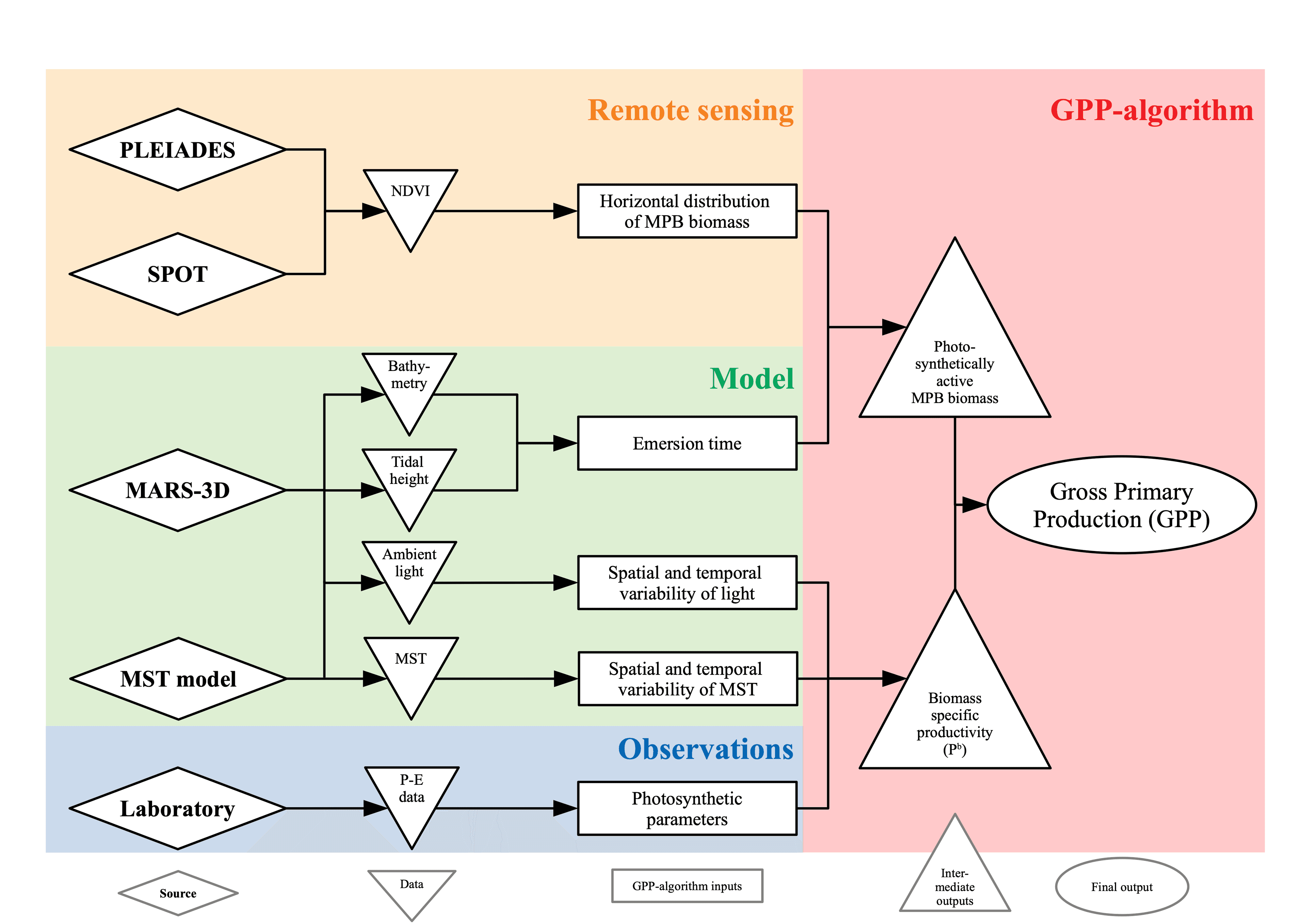
The approach is designed to leverage the strengths of each source while mitigating their individual limitations: satellite imagery provides expansive spatial coverage at fine horizontal resolution, ocean and climate models supply long‑term temporal continuity and broad‑scale dynamics, and laboratory or in‑situ observations anchor the results with highly constrained, site‑specific precision. Through statistical blending, spatial weighting, and error‑minimization techniques, the algorithm delivers new data products that fill temporal gaps, reduce uncertainty, and bridge the scale mismatches between observations and simulations. The result is a unique, multi‑source dataset that is both highly resolved and reliably grounded — ideal for monitoring environmental changes, supporting resource management, and feeding into predictive modeling and decision‑making platforms. This approach demonstrates how a well‑designed data integration workflow can harness the best of each data stream, yielding richer insights and more actionable information about complex marine and coastal dynamics.

Read the full story here: Article in Frontiers in Marine Science.